Back भरतपुर AWA भरतपुर, नेपाल Bihari ভরতপুর মহানগর Bengali/Bangla Bharatpur (lungsod sa Nepal, Madhyamanchal, Nārāyanī Zone) CEB Bharatpur Czech Bharatpur (Nepal) German भरतपुर महानगरपालिका DTY Bharatpur, Nepal English Bharatpur (Nepala urbo) Esperanto Bharatpur Basque
| Bharatpur Upmahanagarpalika भरतपुर उपमहानगरपालिका Bharatpur | |||
|---|---|---|---|
| |||
| Koordinaten | 27° 41′ N, 84° 26′ O | ||
| Basisdatn | |||
| Stoot | Nepal | ||
| Mitte | |||
| Zone | Narayani | ||
| ISO 3166-2 | NP-NA | ||
| Distrikt | Chitwan | ||
| Häh | 208 m | ||
| Flächn | 242,3 km² | ||
| Eihwohna | 199.867 (2011) | ||
| Dichtn | 824,9 Ew./km² | ||
| Gründung | 1979 | ||
| Website | www.bharatpurmun.gov.np | ||
| Stadtrecht 2. Ordnung 29 Wards | |||
 Narayanghat
| |||

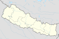
Bharatpur (Nepali: भरतपुर) is de fimftgreßte Stod in Nepal (Distrikt Chitwan). Sie hod a Fläch vo 242,3 km² und 199.867 Einwohna (2011). De Stod liegt ebba in da Mittn vo Nepal im Chitwan-Tal und is ebba 146 km vo Kathmandu entfernt.